RouteMaster allows administrators to see where their buses are, and how fast they’re traveling, at every step along their route. The client was able to cut their overhead costs in half, and fuel growth into new school districts.

The vast majority of American school buses still remain completely unaccounted for while on the road. In many cases, neither parents nor school administrators know the location or state of the school bus until it arrived at its destination.
This compelled the client to create RouteMaster – a real-time school bus tracking and monitoring solution for security-conscious school districts.
RouteMaster currently services three large school districts in the Lehigh Valley region of Pennsylvania.
The first iteration of the RouteMaster system utilized Android phones to serve as tracking devices for their fleet. The phones’ built-in Global Positioning System (GPS) made for a fairly simple implementation process; and its complete operating system (Android) facilitated a wide range of functionality. The client could remotely control each device over the air, allowing them to do anything someone could do with their hand from afar.
However, the devices required a fair amount of tinkering and development to get them to work as asset trackers, rather than phones. What’s more, the Android-based devices were also costly, power inefficient, and data hungry.


RouteMaster system tracks and monitors roughly 300 buses as they weave across the region, carrying thousands of children to and from school.

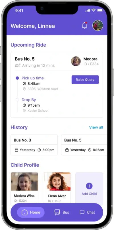
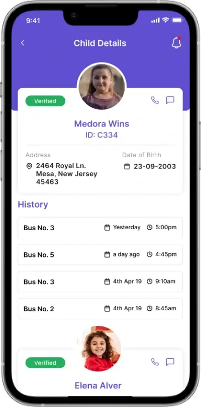
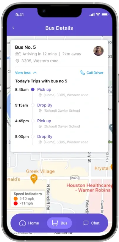
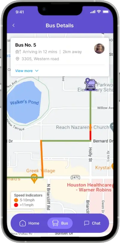
In addition to real-time location tracking, RouteMaster provides live state monitoring around speed, power cord connectivity, and battery life.

Parents and/or school administrators can then follow the state of the school bus on an easy-to-use, Google Maps based interface.

Data can also be retrieved and saved in the form of detailed reports, which administrators can then maintain for recordkeeping and disciplinary purposes.

Administrators can request comprehensive speed-limit reports, for example, which help to ensure driver safety and legal compliance.

All speeding violations are visualized as colored dots superimposed over the map. Example; Orange dots are used to represent minor overages (5-10 mph over the limit), while red dots represent excessive speeding (≥ 11 mph over).
Hire Skilled, qualified, fully-vetted, local runners who are willing to perform tasks and chores for others in their neighborhood.
The Task Poster sets a maximum price for a chore or errand and local users will bid for the job.
Convenient & quick login with Gmail and Facebook; and, visibility to real-time status of the task in terms of acceptance, completion, etc.